



3 years ago
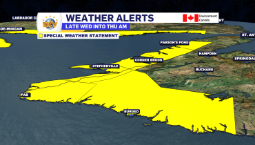
Western, southern Newfoundland under Special Weather Statement for late Wednesday into Thursday
THIS ALERT HAS BEEN MODIFIED AND IS NO LONGER IN EFFECT The Environment and Climate Change Canada Weather Office in Gander has issued a Special Weather Statement for the following areas from late Wednesday into early Thursday morning: Snow and strong winds are expected to develop over southwestern Newfoundland Wednesday evening, then spread northward through […]
Read more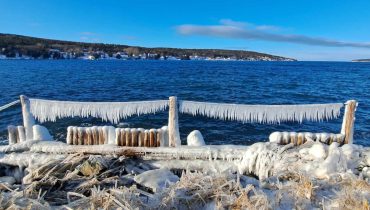
3 years ago
Quiet Tuesday before some snow and rain return later Wednesday
The weather across the Province will generally remain relatively uneventful over the next 24 to 48 hours. Other than scattered flurries for coastal Labrador and portions of Central and eastern Newfoundland and onshore flurries for parts of the West Coast, not much will be on the go. That being said, it will be chilly and […]
Read more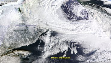
3 years ago
Windy conditions continue on Monday, as large low swirls south of Greenland
The area of low pressure that brought Friday’s snowfall to eastern Newfoundland continues to impact the weather across Newfoundland and Labrador as we begin the new week. As that low passed the Island, it rapidly intensified and then stalled south of Greenland, and that’s where we find it parked this morning. This low is driving […]
Read more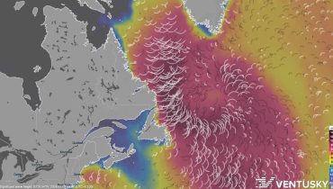
3 years ago
Large waves along northeast Newfoundland and northern Avalon Avalon shorelines into Tuesday
THIS ALERT HAS BEEN ENDED Updated at 6:57 AM NST on January 8, 2024 to reflect the changes to the alerts and the storm surge warning for St. Joh’ns & vicinity. An intense storm will remain nearly stationary south of Greenland for the next several days. This system will produce long-period swells, with large breaking […]
Read more