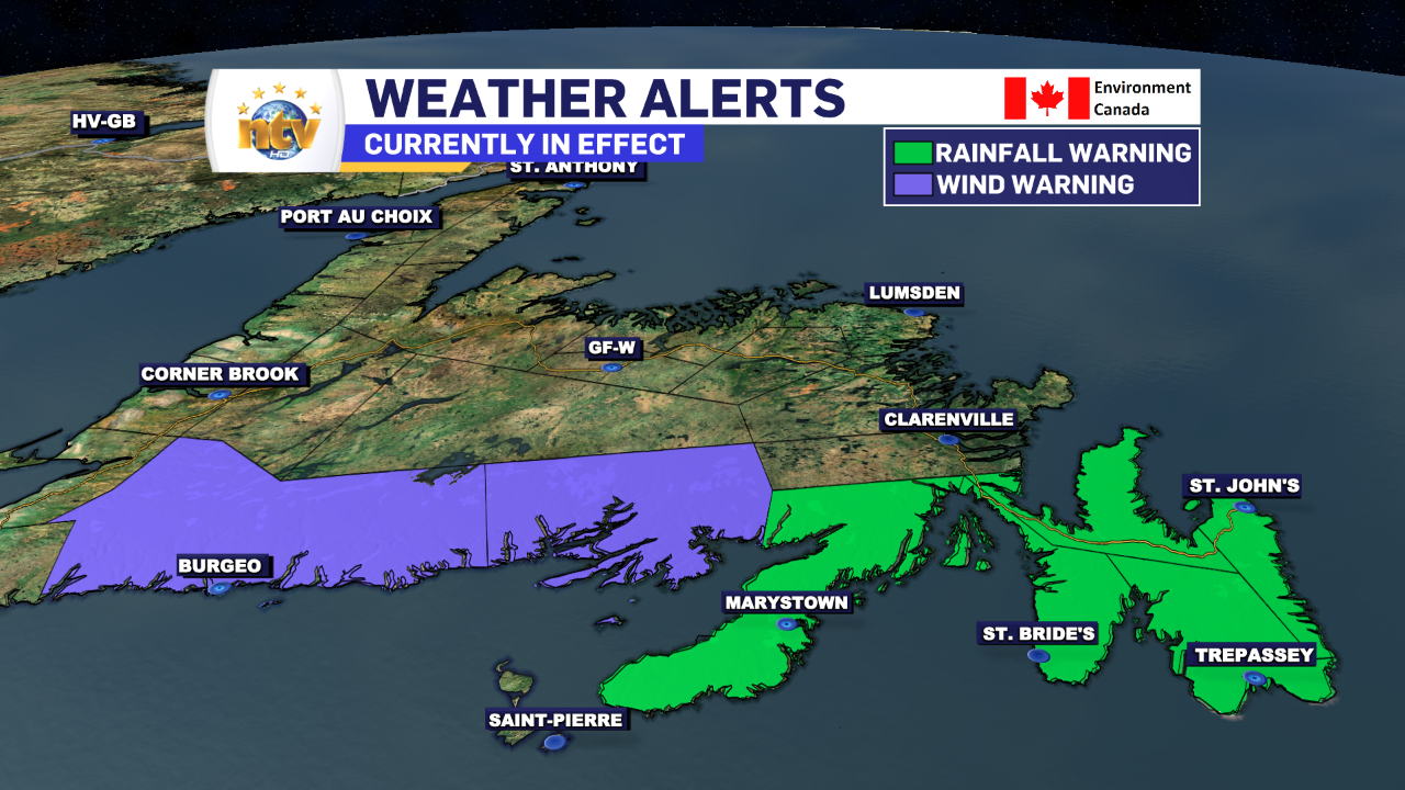
Rainfall and wind Warnings in effect for Monday for eastern and southern Newfoundland
THESE ALERTS HAVE BEEN ENDED
The Environment and Climate Change Canada Weather Office in Gander has issued a RAINFALL WARNING, which will end Tuesday morning, for the following areas:
- The Avalon Peninsula North
- The Avalon Peninsula Southwest
- The Avalon Peninsula Southeast
- The Burin Peninsula
Current details: Rain, at times heavy, is expected.
Total rainfall: 30 to 50 mm with locally higher amounts possible.
Locations: southeastern Newfoundland.
Time span: today until Tuesday morning.
Similar storms in the past have caused minor flooding and hazardous driving conditions.
Remarks: Rainfall rates may reach 5 to 10 mm per hour over some areas.
Rainfall warnings are issued when significant rainfall is expected.
The Environment and Climate Change Canada Weather Office in Gander has issued a WIND WARNING, through early this afternoon, for the following areas:
- Burgeo – Ramea
- Connaigre
Current details: Strong winds that may cause damage are expected or occurring.
Maximum gusts: northeasterly 80 km/h, except 100 along exposed areas of the coast.
Locations: Burgeo – Ramea and Connaigre.
Time span: this morning until early this afternoon.
Damage to buildings, such as to roof shingles and windows, may occur.
Wind warnings are issued when there is a significant risk of damaging winds.
Related Articles